Entry #2: Banning State Park, MN
Trip Details:


Date: Saturday May 16th-Sunday May 17th.
Rating: High.
Top Reason To GO:
Hike the sandstone Kettle River gorge witnessing the thundering whitewater--more of a North Shore or Colorado type feeling--all a 90 minute drive from Minneapolis.
Hike the sandstone Kettle River gorge witnessing the thundering whitewater--more of a North Shore or Colorado type feeling--all a 90 minute drive from Minneapolis.
Do Not Miss:
Hike along Kettle River-Boat Ramp to Quarry Trail Loop and return (optional Hell's Gate Trail extension).
Fun for Kids?
Yes and No. YES if your family likes to explore and/or enjoy a campsite or a picnic by a river. NO if what your family is looking for a structured recreational experience--swimming beach, playground, interpretive center, etc.
Brad's Quick Take:
Often when I reference Banning to friends--the answer (even to outdoorsy friends) typically is "Where's that at again?" My reply--about 15 minutes north of Hinckley just east of I-35. In my opinion, Banning is the most remarkable outdoor experience within 90 minutes of Minneapolis--hands down--no contest/no runner up. It's just at a higher sensory level than all other meandering rivers/streams south of Duluth or open prairies/lakes. That said--if you don't know where to look, you may miss the "wow" spots along the Kettle I'm talking about.
Inside the Park, the Kettle River narrows into a deep gorge creating an unmistakable whitewater sound that fills much of the Park. Within the Park you'll experience historic quarry remnants from the 1880s, pockets of white and red pine stands amongst a mixed hardwood forest, kayakers shooting the rapids, an array of birds/plants including a cool area of large Skunk Cabbage by the Boat Ramp, a waterfall, and rock outcroppings that overhanging the Kettle--perfect to sit and reflect alone or enjoy with company. While a great place to camp, Banning is also a good half day road out and back road trip from the Cities.
NOTE: If you have children who do not listen well--this is not the park for you. If your son or daughter falls into the Kettle River off a cliff at high water levels and is not a good swimmer--the result maybe CPR, not a time out.
 Park History
The Park was named after Banning, an abandoned townsite inside the Park dating back to the 1880s. The Banning townsite was named after William L. Banning, the president of the St. Paul and Duluth Railroad that serviced the sandstone quarry. Many names of the rapids (Hell's Gate) and trails (Deadman Trail) revert back to when loggers in the 1800s floated old growth logs perilously into this difficult section on their way to the St. Croix--many losing their lives.
Banning State Park was established in 1963 with multiple subsequent expansions increasing its size to 6,237 acres. Credit for the Park dates back to 1959 and the Pine County Historical Society's interest to protect the old town of Banning.
Now the Kettle River that flows through the Park is a designated Minnesota Wild and Scenic River. Why does this matter? Well a Kettle River Management Plan and State Rules cover this specific segment of the Kettle so it will look and feel the same for your grandkids--sound good?
Camp Site Experience:
 Camp Site: 33. Campground Map.
Camper Cabin: YES. One Cabin.
Quiet Rating: Average to Below Average. Chorus of frogs in May, occasional distant train, distant highway sounds that die off at night, distant neighbor property sounds that also die off at night.
Comments: I've camped at Banning twice. The campground is not large, but has full shower and water accommodations. There are no cart in or hike in camp sites. Sites 19. 21. 23. 25. 27, 29, 33, and 34 are best and don't back up to neighbors--with 33 and 34 ranked highest in my book (don't book them when I'm going--OK?).
TIPS:
1) Always double check if there are 1 or 2 tent pads on a given site. I believe 33 has 2 and 34 has 1. Some of these sites are raised 2' via woodchips off the forest floor due to seasonal water/moisture. The tent pad woodchips were dry to the touch. The rest of the site was great, but damp dirt.
2) In May, the frogs can be very loud late into the night. Exciting for some, but some loss of sleep for the sound sensitive type.
Best Picnic/Snack Spots:
Easy: Teacher's Overlook--Picnic Tables Provided. Easiest Access from Boat Launch Area.
Medium: Hell's Gate Trail Rock outcroppings on Kettle just south of Quarry Loop Trail--Need Blanket--eat on rock/ground.
Best Picnic/Snack Spots:
Easy: Teacher's Overlook--Picnic Tables Provided. Easiest Access from Boat Launch Area.
Medium: Hell's Gate Trail Rock outcroppings on Kettle just south of Quarry Loop Trail--Need Blanket--eat on rock/ground.
Hiking/Exploring:
 |
| An Incline to Teacher's Overlook from Quarry Loop Trail |
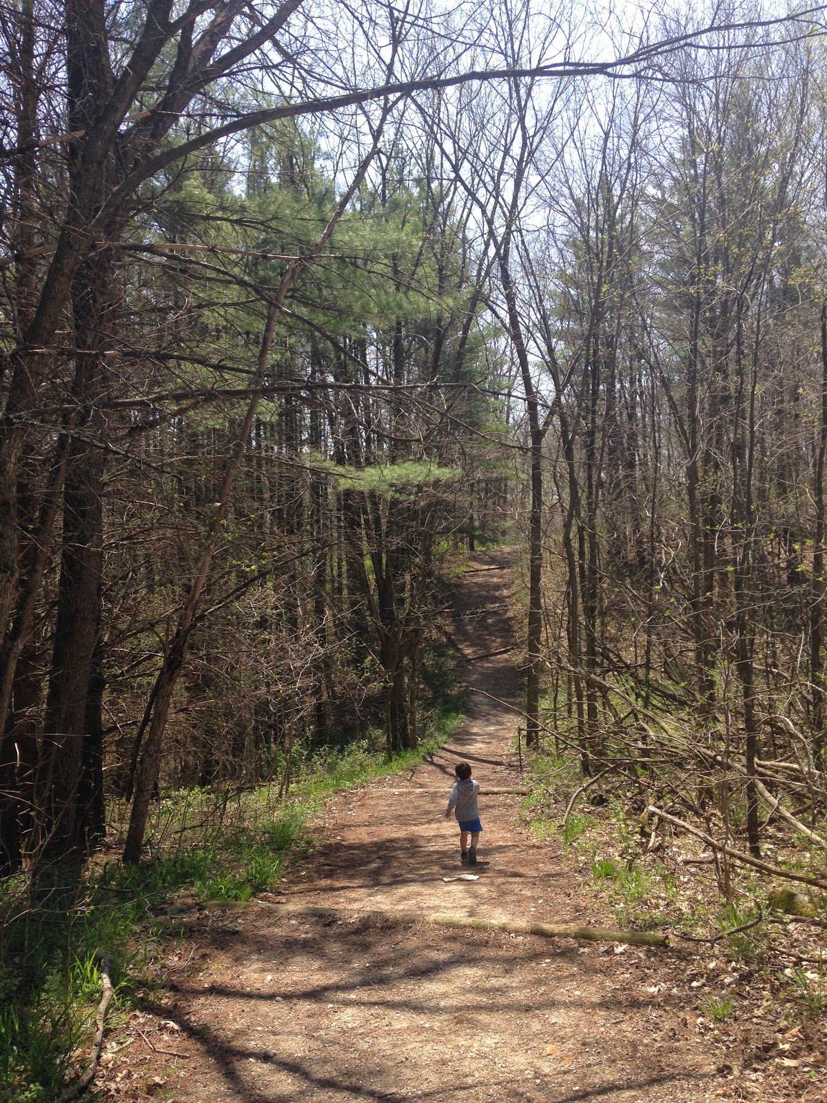
Banning hikes range from upland bluff hikes with approximately 10' width of mowed grass to river walks that range from raised/dry former rail line to narrow almost bog like conditions. If you show up with only sneakers, you may have to get your feet wet, turn back, or select only a dry hike. Big picture, I'd recommend a waterproof hiking boot first and foremost if you intend to cover much ground--particularly if you are heading to the Wolf Creek Falls or one the Bluff top trails or the Skunk Cabbage Trail. One would think the Bluff traverse trails would dry--but the thin soil to rock holds water, even when you'd expect them to be dry.
Banning Summer Hiking Map
Banning Summer Hiking Map
Hike #1: Campground to Boat Launch (and return).--Moderate to Difficult
 |
| Deadman Trailhead |
This leisurely 1.5 to 2 hour loop hike begins at the Campground immediately off the loop before you exit. You'll see a path and 2 immediate options--Deadman Trail or Wolf Creek Trail--Select Deadman Trail (don't worry, much scarier than reality) and head downhill. At the first intersection a few minutes into the hike head left downhill towards the Quarry Loop Trail. The second intersection is a few minutes later, head right towards the Hell's Gate Trail. This section walks past 100' vertical rock outcroppings left from the old quarry.
At the third intersection, you have two options: head right downriver on the Hell's Gate Trail or head left upriver on the Quarry Loop Trail. If you have extra time, I advise the Hell's Gate Trail spur--this section has some of the best spots to sit elevated right along the river to enjoy a snack, meditate/reflect, etc. Feel free to stop/turn around and avoid the challenging section or the water crossing--I have never ventured through this section.
Once you head upriver through the Quarry Loop Trail-there is an interesting Self-Guided Trail (pamphlets at the Ranger Station) through the old Banning Quarry with building remnants. This portion of the hike is flat along the old railroad line.
 |
| Skunk Cabbage |
 |
| Kettle River at Boat Launch (before rapids) |
 |
| Teacher's Overlook |
 |
| Tributary to Kettle off Spur Trail |
 |
| Trillium along Spur Trail |
Hike #2: Campground to Wolf Creek Falls--Moderate to Difficult
This roughly 2.0 mile out and back trail takes you along the top of the bluff direct from the Campground to Wolf Creek Falls. The Falls is nice, but not breathtaking. This falls in most State Parks south of Duluth would be the main feature. Here, the Kettle River rapids take center stage--thus Wolf Creek Falls should be your second or optional hike. This section can be more wet than most and require waterproof hiking boots. Depending on the season and the rain--you'll know soon if you have to turn around. It is best to try the hike as a loop taking High Bluff Trail out and Wolf Creek Trail back. Start out on Deadman Trail and immediately turn right onto the High Bluff Trail. You'll stay on this trail for .6 miles until the intersection with the Wolf Creek Trail. Turn left to Wolf Creek Falls. From here the path ventures down and will require some coordination to navigate the rocks. There are a few different poorly signed viewing points of the falls with access depending on the water level. Just look around, enjoy it and turn back when you are ready. The falls is nice, but not
Arrival Last Minute Needs:
Local Groceries: Chris' Food Center (Sandstone--15 minutes)
Local Beverages: Finlayson Municipal Liquor (Finlayson 15 minutes)
NOTE: Banning is the Askov/Finlayson exit--there is only gas with basic drinks/snacks. I advise pack/prep food at home, drive straight to Banning for a camp meal and skip the traffic/fast food chaos of the Hinkley exit.
Adjacent Parks/Activities to Link:
Moose Lake State Park State Park with Swimming Beach. 20 Miles North via I-35.
Willard Munger Trail Paved State Bike Trail. Access in Finlayson--15 minutes West off 15.
Willard Munger Trail Paved State Bike Trail. Access in Finlayson--15 minutes West off 15.